


Fort Snelling Unorg. P-1, Hennepin County, Minnesota
About
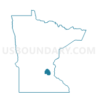
Outline

Summary
| Unique Area Identifier | 602326 |
| Name | Fort Snelling Unorg. P-1 |
| County | Hennepin County |
| State | Minnesota |
| Area (square miles) | 7.64 |
| Land Area (square miles) | 7.28 |
| Water Area (square miles) | 0.36 |
| % of Land Area | 95.24 |
| % of Water Area | 4.76 |
| Latitude of the Internal Point | 44.87952760 |
| Longtitude of the Internal Point | -93.22430680 |
Maps


Graphs
Select a template below for downloading or customizing gragh for Fort Snelling Unorg. P-1, Hennepin County, Minnesota


Neighbors
Neighoring Voting District (by Name) Neighboring Voting District on the Map
- Bloomington W-4 P-1, Hennepin County, MN
- Eagan P-4, Dakota County, MN
- Mendota Heights P-3, Dakota County, MN
- Minneapolis W-11 P-6, Hennepin County, MN
- Minneapolis W-11 P-8, Hennepin County, MN
- Minneapolis W-11 P-9, Hennepin County, MN
- Minneapolis W-12 P-10, Hennepin County, MN
- Minneapolis W-12 P-7, Hennepin County, MN
- Minneapolis W-12 P-9, Hennepin County, MN
- Richfield W-3 P-1, Hennepin County, MN
- Richfield W-3 P-9, Hennepin County, MN
- St. Paul W-3 P-5, Ramsey County, MN
Top 10 Neighboring County Subdivision (by Population) Neighboring County Subdivision on the Map
- Minneapolis city, Hennepin County, MN (382,578)
- St. Paul city, Ramsey County, MN (285,068)
- Bloomington city, Hennepin County, MN (82,893)
- Eagan city, Dakota County, MN (64,206)
- Richfield city, Hennepin County, MN (35,228)
- Mendota Heights city, Dakota County, MN (11,071)
- Fort Snelling UT, Hennepin County, MN (149)
Top 10 Neighboring Place (by Population) Neighboring Place on the Map
- Minneapolis city, MN (382,578)
- St. Paul city, MN (285,068)
- Bloomington city, MN (82,893)
- Eagan city, MN (64,206)
- Richfield city, MN (35,228)
- Mendota Heights city, MN (11,071)
Top 10 Neighboring Unified School District (by Population) Neighboring Unified School District on the Map
- Minneapolis Public School District, MN (382,583)
- St. Paul Public School District, MN (285,068)
- Bloomington Public School District, MN (82,887)
- West St. Paul-Mendota Heights-Eagan School District, MN (42,099)
- Richfield Public School District, MN (39,922)
- School District Not Defined, MN (144)
Top 10 Neighboring State Legislative District Lower Chamber (by Population) Neighboring State Legislative District Lower Chamber on the Map
- State House District 63B, MN (37,315)
- State House District 64B, MN (37,227)
- State House District 38A, MN (36,837)
- State House District 62B, MN (36,748)
- State House District 39A, MN (36,477)
- State House District 62A, MN (36,311)
Top 10 Neighboring State Legislative District Upper Chamber (by Population) Neighboring State Legislative District Upper Chamber on the Map
- State Senate District 39, MN (77,255)
- State Senate District 63, MN (74,746)
- State Senate District 38, MN (73,200)
- State Senate District 62, MN (73,059)
- State Senate District 64, MN (72,961)
Top 10 Neighboring 111th Congressional District (by Population) Neighboring 111th Congressional District on the Map
- Congressional District 2, MN (732,515)
- Congressional District 3, MN (650,185)
- Congressional District 5, MN (616,482)
- Congressional District 4, MN (614,624)
Top 10 Neighboring Census Tract (by Population) Neighboring Census Tract on the Map
- Census Tract 376.02, Ramsey County, MN (4,857)
- Census Tract 1105, Hennepin County, MN (4,694)
- Census Tract 119.98, Hennepin County, MN (3,980)
- Census Tract 376.01, Ramsey County, MN (3,915)
- Census Tract 607.25, Dakota County, MN (3,461)
- Census Tract 606.04, Dakota County, MN (3,199)
- Census Tract 117.04, Hennepin County, MN (3,171)
- Census Tract 121.01, Hennepin County, MN (3,159)
- Census Tract 121.02, Hennepin County, MN (2,819)
- Census Tract 251, Hennepin County, MN (2,570)
Top 10 Neighboring 5-Digit ZIP Code Tabulation Area (by Population) Neighboring 5-Digit ZIP Code Tabulation Area on the Map
- 55423, MN (35,375)
- 55417, MN (24,875)
- 55116, MN (23,851)
- 55425, MN (8,952)
- 55121, MN (7,861)
- 55120, MN (4,352)
- 55150, MN (198)
- 55450, MN (10)
- 55111, MN (0)